Detailansicht
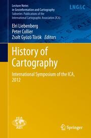
History of Cartography
International Symposium of the ICA, 2012, Lecture Notes in Geoinformation and Cartography - Publications of the International Cartographic Association (ICA)
ISBN/EAN: 9783642333163
Umbreit-Nr.: 3936722
Sprache:
Englisch
Umfang: ix, 336 S.
Format in cm:
Einband:
gebundenes Buch
Erschienen am 05.09.2013
Auflage: 1/2013
- Zusatztext
- InhaltsangabeRedefining Imperial Borders: Marking the Eastern Border of the Habsburg Monarchy in the Second Half of the Eighteenth Century.- Exploring and mapping the Danube: Reading a hydrographical map of Buda and Pest (1833).- Saxony's role in the measurement of the Central European Meridian Arc as an international geodetic project since 1862.- Media-related Aspects of Popularization: The Geographical Serials from the Publishing Houses of Friedrich Justin Bertuch.- Exploring along the Rome Meridian - Roger Boscovich and the First Modern Map of the Papal States.- The Mineral Maps of L. F. Marsigli and the Mystery of a Mine Map.- The long life of a 1:200 000 map of Central Europe and the Balkans.- Villages, Actors of Local Cartography? The Cadastral Maps of the Banat (1772-79).- The Historical Evolution of Craiova Municipality (Romania) Results from the Analysis of Cartographic Documents.- A Brief History of the Boundary Mapping Between Indonesia and Timor-Leste.- Colonial Powers and Geographic Naming -A Case study of Orchid Island (Lanyu), Taiwan.
- Kurztext
- This volume collects 22 papers presented at the 4th International Symposium of the ICA Commission on the History of Cartography, held at Eötvös Loránd University, Budapest, Hungary, on 28-29 June 2012. The overall conference theme is 'Exploration - Discovery - Cartography', but preference has been given to papers dealing with cartography in the 19th and 20th centuries. The papers are classified according to regional sub-themes, i.e. papers on the Americas, papers on Africa, etc.
- Autorenportrait
- InhaltsangabeRedefining Imperial Borders: Marking the Eastern Border of the Habsburg Monarchy in the Second Half of the Eighteenth Century.- Exploring and mapping the Danube: Reading a hydrographical map of Buda and Pest (1833).- Saxony's role in the measurement of the Central European Meridian Arc as an international geodetic project since 1862.- Media-related Aspects of Popularization: The Geographical Serials from the Publishing Houses of Friedrich Justin Bertuch.- Exploring along the Rome Meridian - Roger Boscovich and the First Modern Map of the Papal States.- The Mineral Maps of L. F. Marsigli and the Mystery of a Mine Map.- The long life of a 1:200 000 map of Central Europe and the Balkans.- Villages, Actors of Local Cartography? The Cadastral Maps of the Banat (1772-79).- The Historical Evolution of Craiova Municipality (Romania) Results from the Analysis of Cartographic Documents.- A Brief History of the Boundary Mapping Between Indonesia and Timor-Leste.- Colonial Powers and Geographic Naming -A Case study of Orchid Island (Lanyu), Taiwan.
